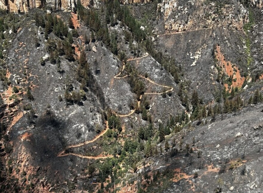
Last month, teams of scientists finalized their reports on how the Dragon Bravo Fire impacted the environment across its 145,000-acre burn area.
They found about 65% burned at a low severity but almost a third suffered moderate and high impacts.
KNAU’s Adrian Skabelund spoke with U.S. Department of the Interior Burned Area Emergency Response Team leader TJ Clifford.
ADRIAN SKABELUND: Can you speak through, in maybe layman's terms, what those areas look like and what that means?
TJ CLIFFORD: For sure. Moderate and high severity, at first glance, the vegetation mortality– the trees have died, and that is consistent throughout Forest Service, Park Service, lands.
But then you come down– soil burn severity is specific to how those soils have been impacted. It's mild and it's not that deep, so that's [the] first look for watershed response.
And then, two other things we noted in the moderate.
We identified them as moderate soil burn severity, but there was no change in the soil structure, and even fine roots were intact.
So when you dig in there with your hand, you're gonna find a lot of the grassroots are still there, intact. They have not been consumed.
And then the other cool thing that we noticed in almost every situation is [that] both shrubs and aspen are re-sprouting already. In some cases on some hills, with the rains we've been receiving over the last week, their re-sprouts are at 18 inches high.
SKABELUND: And are those re-sprouting or are re-growing in areas of high burn severity, or is that more in low to moderate?
CLIFFORD: It includes the moderate. Low, of course, yes. Low, we expect that to come back very quickly, within the first year.
Moderate, on some fires, we do not expect that to happen until about two years out, and high would be longer.
SKABELUND: Is it too early for us to know the implications for debris flows and runoff into some of these drainages down to the Colorado?
CLIFFORD: It is too early. We're still in the modeling phase. But I will say that USGS has a product out there already for the debris flows, so they have talked about that.
When you look at those debris flows, I think most importantly you would, you would pay attention to the likelihood, and that, for the most part, is 0% to 40%.
So yes, there is an increase of likelihood of a debris flow happening.
I think we're seeing the same thing with when you have a regular [precipitation] event and it doesn't get to that level of a debris flow. It's more of a flood.
And to talk specifically Bright Angel, Transept — those canyons — we are seeing increases, but they're not substantial.

SKABELUND: What are the next steps for a report like this?
CLIFFORD: What we do right now is we're putting together the rationale to mitigate some of the threats to public safety. For instance, we got rockfall on the trails.
We have some areas within the North Rim development area that we need to stabilize because of hazards. A burn structure usually equates to hazardous material, and we need to help stabilize that until that hazardous material can be removed.
Our program will work to bridge the gap between the fire and the restoration, and that includes that developed area.
I will say that part of what the park would be looking for is specifically North Rim trails. So we lost the vegetation holding the rocks on the hill slope. That rock fall will happen and hit the trail in multiple locations, especially in the steeper sections, much more often.
And that is a risk that the park needs to understand so that they know how to, whether or not to allow visitors to keep using the trail system.
That would be kind of a spinoff product of, uh, when we look at this, we're looking at life and property first and natural and cultural resources second.
SKABELUND: TJ, thanks so much for giving me some of your time today.
CLIFFORD: Yeah, thank you.
This conversation has been edited for length and clarity. Find the extended version here.


